My Short Story ‘Christmas Gift’ Published in a Minnesota Book :)

Minnesota's Emerging Writers: An Anthology of Fiction

YAY…!!! Finally its here. In my hands. In my heart! I am excited to present it to you as my best ever ‘Christmas Gift’.

My first short story titled “Christmas Gift” is now published in a book. Story is part of the book titled “Minnesota’s Emerging Writers: An Anthology of Fiction” and is now available for purchase on the publisher’s website. Book is a compilation of 33 short stories, all written by authors from the state of Minnesota. Isn’t that something to be proud of as Minnesotans? Feels so proud, and at the same time very much humbled by this moment.

This book has been published by Z Publishing House, a Wisconsin based publisher. Stories contained in this book cover ‘a wide array of genres ranging from literary fiction to satire, mystery, comedy, science fiction and more’. This book is priced at $14.99, and is available for purchase on the publishers website. I get some commission for every sale made through my affiliate link.

You can read excerpts of my story in the photo attached here. Let me know if you want to read the complete story, along with other 32 short stories, written by emerging writers from Minnesota.

Minnesota's Emerging Writers: An Anthology of Fiction

Do you want this Christmas to gift this ‘platter of words’ to yourself or to your loved ones? Show some love, purchase the book, share this post on your social media channels, review my story and share it .

Facebook   Instagram   Twitter

https://www.zpublishinghouse.com/products/minnesotas-emerging-writers-an-anthology-of-fiction?variant=13417629515891&rfsn=2054094.cf8b9d

Posted in Art & Culture, Awards, Dreams, Life, Minnesota, Social Media, USA, Writing | Tagged , , , , , , , , , , , , , , | 11 Comments

Mobius Arch in Alabama Hills

Mobius Arch in Alabama Hills

I was sitting on the rock facing the Mobius Arch, seeing the full moon set in the west. It was a quiet and beautiful morning with solitude in perfection. Being the next day after Thanksgiving Day, there were lot of campers in the Alabama Hills who had spent their nights in the hills, in the lap of nature, cradled between the Sierra Nevada Mountains and the Alabama Hills.  This place is managed by Bureau of Land Management (BLM) and you can camp here for free for a maximum of consecutive seven days. No permits required. During one of my earlier trips to Death Valley, I had attempted to visit Alabama Hills but had to return half-way. This time, however, I was determined to visit and capture the serenity and contour of this place. Alabama Hills is over 100 miles away from Furnace Creek visitor Center in Death Valley National Park, and takes over 2 hours to reach. But this is a good side trip to do when you are exploring this region.

Alabama Hills is an amazing place with many arches, rock formations and small hills to the east of Sierra Nevada mountains. The round boulders of Alabama Hills are in sharp contrast to the sharp ridges of Sierra Nevada mountain to the west. Tall peaks of Sierra Nevada mountains, in the eastern part of California, literally dwarfs the smaller Alabama Hills. Alabama Hills is also home to hundreds of old Hollywood movies which were shot here.

Mobius Arch, largest and most picturesque arches in Alabama Hills, frames the Lone Pine peak and Mount Whitney, tallest mountain in the lower 48 states of USA.  As shown in the shot above, this is not a very big arch with the arch window rising to 6.5 feet. Trail to the Mobius Arch is a loop, and the shortest and fastest way to hike to the arch is by starting the hike on the left side of the parking lot. It is 0.25 miles from the parking lot on this well-maintained trail and takes less than 10 minutes. There are over 400 arches in the Alabama Hills. This database link has the listing of around 300 arches in the Alabama Hills.

When to Visit: Summer can be very hot, considering this is a desert environment. Spring and fall are the best time of the year with cottonwood trees changing colors in the month of November. Winter temperature is also suitable for a visit. If you are into photography, sunrise and sunset are the preferred time of the day. I took pictures of this arch at both times of the day, but I prefer sunrise at the Mobius Arch.

Entrance Fees: It is FREE. There is no permit to even camp in Alabama Hills.

Where is it: Alabama Hills is located less than three miles from the town of Lone Pine in Inyo County, California. Visit here for maps and coordinates. From Lone Pine, drive on to Whitney Portal Road for 2.7 miles. Then turn right on Movie Flat road, which is marked. This road starts as a paved road but soon turns into a wide, dirt road, which any car can manage. After driving for about 1.5 miles, you will reach a fork on the road. Take right at the fork, and the parking lot for Mobius Arch trailhead is right there on your left.

Hiking Trail to Arch: It is a mile-long loop. Shortest and easiest way to the arch is to start at the trailhead on the left side of the parking lot. Trail goes downhill for few meters, and then you reach a small wash. You will find a split in the trail. Here stay right on the trail which is also a marked Arch Trail loop sign. Hike becomes slightly uphill for about next 500 yards. You will reach a heap of rocks. If you carefully look on the right side of the trail amidst the rocks, you will first notice the Lathe Arch just besides the trail. Hike further 20 feet, and Mobius Arch will be on your right. This is a quick 10 minutes hike of about 0.25 miles to the arch from the parking lot.

If you start your hike at the trailhead on the right side of the parking lot, this is slightly longer and can be also little confusing.

Things to Do in Alabama Hills:

  • You can visit few of the more popular arches in the Alabama Hills, namely, Mobius Arch, Lathe Arch, Heart Arch, Cyclops Arch, Eye of the Alabama Hills, Boot Arch and Gunga Din arch. .
  • Camping is free here. You can choose a sweet spot for yourself, tucked amidst the rocks, and spend the night under the zillion stars. This is also a great spot to spend time with your kids.
  • Alabama Hills is also the place where hundreds of old Hollywood movies were shot. You can visit these spots as well. If you want to know about the movies shot here, you can stop at the Movie Museum in Lone Pine.
  • Horseback riding and mountain biking are also very popular here.
  • You can also take a shot at rock climbing, as there is no dearth of rocks here.
  • Or like me, indulge in photography, and capture the beauty of this place
Posted in California, Nature, Photography, Sunrise, Travel, USA | Tagged , , , , , , , , , , , , , , , , , , , , , , | 10 Comments

Minnesota, Our Home

Duluth Northpier Lighthouse

Few years back, we had never imagined that in time to come, we would be living in one of the coldest places in USA. Then it seemed highly unlikely that coming from the tropical place like India, we would even survive the harsh and six-month long winters of Minnesota, which we proudly call our home now. As a matter of fact, Alaska and Minnesota often compete to be the coldest place in USA. In India, we were so used to live in the summer when maximum temperature used to hover around 40-45° Celsius (104-113° F). There we had never lived in a place where snowfall occurred. Even the winter temperature reached minimum of only 3-5° Celsius (37.4-41° F).

Things changed in 2014. We landed in Minnesota and that too, in winter month. Within few days, we had experienced the temperature going down to -30° Celsius (-22° F). Yes, you read it right! We hated our first winter, and waited for the winter to get over, which proved to be a distant dream for next 6 months. Now i seem to enjoy the winter, because  now i can appreciate how the entire landscape and scenery changes in winter with its white blanket of snow everywhere. This gives me plenty of photographic opportunities, and adds variety to my shots. I can never imagine similar shots in my hometown in India, unless i move to the Himalayan regions of India which host snow capped mountains. This year, winter ended last month, and we are enjoying the warm summer days now. To be very honest, spring here is very short, usually less than a month. So, i always mention that we Minnesotans almost directly traverse from winter to summer.

Now i am glad to mention that i love calling Minnesota our home. It is a beautiful state in the mid-west of USA. Especially, as a photographer and someone who loves travelling, i am very much pleased with the natural beauty of the state. From the wilderness of Boundary Waters to the largest freshwater lake in the world by surface area – Lake Superior, Minnesota has much to offer in terms of natural beauty. It is the state to more than 10,000 lakes, and pristine locations in the North Shore. With more than a couple dozen Fortune 500 companies based out of the state, Minneapolis is the second biggest job market in mid-west after Chicago. State has one of the best living standards in USA and has lower than nation’s average unemployment rate. Taking the holistic picture of the state, i am proud to make it our home. Probably, the only thing i miss in Minnesota is the snow-capped mountains, but otherwise, there is no dearth of snow in the state during cold months.

Above photograph is of the Duluth North Pier Lighthouse, in the picturesque town of Duluth in the North Shore region of Minnesota.

Posted in Minnesota, Nature, Photography, Travel, USA, winter | Tagged , , , , , , , , , , , , , | 5 Comments

Sunset at Minnesota Valley National Wildlife Refuge, Bloomington

Minnesota Valley National Wildlife Refuge

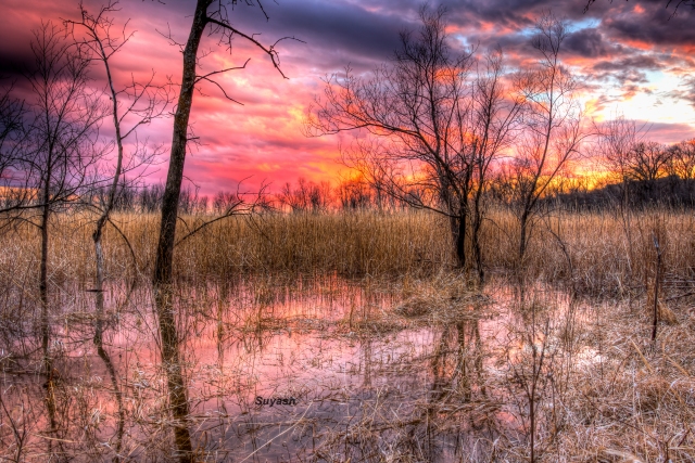
It is almost end of April but we Minnesotans may have to still wait for spring. Yesterday (April 27, 2018), if you were in Duluth or North of Minnesota, you would have experienced the snow fall. Amazing, isn’t it? This is Minnesota for you dear, and I love this place. By the way, cheer up, for the spring is on its way.

Yesterday, it was bit cloudy, with sun playing hide and seek behind the clouds. It was windy as well with little drops falling off from the heavens, which made the weather chilly. I was pretty excited seeing the clouds and its game. Of course, this meant that if clouds persisted till evening, we might see a beautiful and gorgeous sunset. Keeping this in focus, i completed my regular activities at home (and procrastinated others), making myself ready for the evening photo shoot. Picked up my Google Maps, and I finally zeroed down to Minnesota Valley National Wildlife Refuge in Bloomington, which i had visited several times. But this particular spot in the refuge, and on this particular trail, this would be my first time. Remind you that Minnesota Valley National Wildlife Refuge stretches for several miles along the Minnesota River. There are several spots and trailheads in the city of Bloomington itself, apart from other cities.

I was racing against the time, and started on the hike. After having hiked down the hill for only 0.2 miles, I realized the trail was closed due to flooding. There was hardly any time to pick up another trail, and was slightly cursing myself for having not scouted my spot in advance or atleast looked up on the website for flooding alerts. Just to let you know that many rivers including Minnesota River is flooding currently due to melting snow. I was disappointed for few seconds and was frantically looking around the woods when i found this spot with little puddle of water. Sigh of relief, and an evening well spent with my Canon 7d Mark II and Sigma Art lens 18-35mm f1.8.

This is the HDR shot, with 5 bracketed exposures, blended in Photomatix Pro 5.1 software and little post-processing in Adobe Lightroom. Aperture Priority Mode, f/11, iso 100, EV -2, -1, 0, +1, +2, focal length 18mm, shutter speed 1/13, 1/6, 1/3, 0.6, 1.3 sec. On tripod

Thanks for your visit. Today’s post is the contribution for this week’s Photo Challenge: Lines. Visit my instagram page here.

Posted in Minnesota, Nature, Photography, Sunset, Travel, Uncategorized | Tagged , , , , , , , , , , , , , | 17 Comments

Watkins Glen State Park, New York State

Watkins Glen State Park

Till I had visited this state park in New York state, I had no clue how beautiful this part of the state is. In fact, other state parks located in the Finger Lakes region of the state, apart from Watkins Glen, is also very beautiful and awe-inspiring. But Watkins Glen State Park simply stands out, I must say. It is the most famous state parks in the state and is located near Watkins Glen village, south of Seneca Lake.

I had visited this park in the September of 2017, after seeing one of the splendid photos of my colleague. Most remarkable feature of this park is it’s 19 waterfalls which dot the map of this park within 2 miles distance. How exciting! Park features three trails but if you are out for waterfalls, take Gorge Trail, which is the most popular among all three. This trail winds along with stream, which runs the 400-foot deep, narrow gorge. Sometimes you walk under falls, and at times, you cross over stone bridges – and Rainbow Bridge too. All along the 2-mile trail, there are more than 800 stone steps, and for most part of the trail, you will be walking almost at the bottom of the gorge between its walls.

When to Visit: Park is open year round. However, Gorge Trail is open only in summer when weather is favorable. From mid-May to mid-October, this trail gets closed. Moreover, trail shuttle service also runs seasonal. You can use the shuttle service to get picked up at the other end of the Gorge Trail, which will bring you back to the parking lot from where you had started the hike on Gorge Trail.

Fees: There is a fee of $8 per vehicle in the park.

How to Reach: There are two entrances to the park. Most popular of the two is near the Watkins Glen village. Second entrance is in the upper part of the park in woodland on Station Road 409.

Posted in Fall Season, Nature, New York State, Photography, Travel, USA | Tagged , , , , , , , , , , , , , | 12 Comments

Weekly Photo Challenge: Cheeky

Leave in Snow

Weekly Photo Challenge: Cheeky

Posted in Nature, Photography | Tagged , , , , , , , , , , | 1 Comment

Oberg Mountain Loop Trail in Tofte, MN

Oberg Mountain, North Shore MN

In the last week’s post, i had shared the panorama photo of Caribou Lake and about the White Sky Rock trail in Lutsen.  In today’s post, i will detail out yet another trail in Cook CountyOberg Mountain loop, which is part of Sawtooth Mountains in North Shore, Minnesota.

Oberg Mountain trail is a 2.2 mile loop trail with 9 scenic overlooks of spectacular views. Once at the top of the mountain, the trail provides beautiful views of Lake Superior, Oberg lake and Moose Mountain. Especially during fall colors, this is must-visit in Cook County to see the red maple. Initial trail has few moderate switchbacks but once at the top of the mountain, trail is relatively easy and in circular loop. This is a spur trail off the Superior Hiking Trail. The above pic is of the Oberg Lake taken from one of the overlooks of the Oberg Mountain, and captures the transformation of leaves and scenery during the fall season, when the leaves turn colorful.

One interesting recommendation i read in many sites and blog is that you should keep to your right at the fork on the top of mountain and walk the trail in anti-clockwise direction. Except during busy time when there can be more people on the narrow trail, i find no particular reason why we should be hiking in anti-clockwise direction. If your sole purpose is to photograph the Oberg Lake, by all means i would suggest you to go left at the fork in clockwise direction, as the distance is shorter this way. But if your idea is to capture the rising sun or the Lake Superior, you must traverse in anti-clockwise direction. Moreover, it also depends on the time of the day and the situation of the light on that particular day, which is to be considered for photography. Having said this, i did not know all this and hence, walked anti-clockwise direction. Given a chance to reverse the day’s decision, i would have walked clockwise direction that day, for simple reason that i wanted to capture this view first as it was little cloudy that day and light was playing its magic. So,  by no means, i wanted to miss this opportunity. Despite this, i was lucky enough to capture this beautiful scenery. So, choose your loop direction – clockwise or anti-clockwise – wisely.

There is a vault toilet at the parking lot and details about both trails – Oberg and Leveaux mountain trails. There are no facilities at the top of mountain. Except one overlook, none of the other overlooks have guard-rails and there are steep cliffs of the mountain. So, use extreme caution.

How to reach: Drive approximately 4.7 miles north of Tofte on Highway 61, North Shore. Turn left at Onion River Road (Forest Road 336), which is marked by a small sign and easy to be missed. Hence, look for the ‘Superior Hiking Trail’ sign on Highway 61 to signal your turn. Drive 2.1 miles on this unpaved road to find the parking lot on the left. Once here, you will find that there are two trails that originate from the parking lot. So, don’t get confused. LeVeaux Mountain Trail, 3.4 miles leading up to the LeVeaux Mountains, starts from the end of the parking lot, farthest from the Onion Road. Whereas Oberg Mountain Trail starts from the opposite side of Onion River Road from the parking lot. Visit here for the map and more information.

When to Visit: Fall is the best season. But views from the overlook will change every season and hence, you can visit it any time of the year. Make sure that if you are visiting it during the crowded fall season, you go early as the parking lot can be pretty full by 9 am. After hiking, when i returned to the parking lot around 10:30 am, cars were parked on both sides of the Onion River Road for about quarter mile, as parking lot was full.

Length of Trail: Loop of 2.2 miles

Have you hiked Oberg Mountain? What was your experience like?

Posted in Fall Season, Minnesota, Nature, Photography, Travel, USA | Tagged , , , , , , , , , , , , | 3 Comments

White Sky Rock Trail in Lutsen, MN

Caribou Lake, North Shore MN

North Shore, located along the beautiful Lake Superior in Minnesota, is a magical place in all seasons. It stretches more than 150 miles from Duluth at the south tip of lake Superior to the Canadian Border in the north. This scenic drive is along the lake on one side and the Sawtooth Mountains on the other side, with several hundred miles of hiking trail.

One such hiking trail is the White Sky Rock hike, overlooking the Caribou Lake and the surrounding maple forests. This trail is part of the Superior Hiking Trail. I hiked it this year in order to capture the fall colors, as this is one of the recommended trails to see the fall color change. Since there are lot of maple trees, view from the overlook is amazing.

While i was there in the last weekend of September, i got to know that maples were past peak. Hence, i was not able to capture lot of red. Despite this, it was worth the hike and the view. Once i was at the overlook, i wanted to capture the view of the lake in one shot, which did not seem possible with my 18-55 mm lens. This was the widest lens i had. An ultra-wide lens would have been more ideal.

Left with no option, I decided to experiment with panorama shot. I took two shots with both shots overlapping almost 30-40%. Since this was the first time i was shooting the panorama shot with my digital SLR camera, i was little short on the experience and instead took 2 shots. Now in the hindsight, i realize that i should have taken atleast 3 shots. Later in the post-processing, i merged both the shots in Adobe Photoshop Element, and did some minor adjustments in Adobe LightRoom. Above shot is the post-processed panorama of the Caribou Lake.

How to Reach: On Highway 61, drive approximately 92 miles North of Duluth. A mile past Lutsen on the Highway 61, drive into the Caribou Trail (County Road 4) for about 4 miles. You will find the Cathedral of the Pine son the right. Drive further to find an unpaved road on the right side which is White Sky Road. There is a small parking area for car and boat launches. You will also find the trailhead sign to the White Sky Rock trail. Follow the short little trail upto the Caribou Trail Road you just came from and cross it. You will find the trail leading uphill into the woods.

Length of Trail: This is a very short hike but with an elevation gain of 230 foot. Trail-head sign mentions 0.3 miles. This is a steep hike but manageable. Half way into the hike, you will reach the junction of White Sky Rock Trail and Lake Agnes Hike. Both are part of Superior hiking Trail. Take the right for White Sky Rock Trail. Overlook is very much exposed with no guardrails. Hence, take care if you have kids.

Best Time to Visit: Fall color is definitely the best time to see maple at its peak. However, you can hike this any time of the year to get the beautiful view. This is one of my recommended hikes and it does not require lot of planning and execution time.

Let me know what do you think of my first panorama shot.

Few of my other posts on fall colors are:

Think Local Travel Global

Great River Bluffs State Park, Minnesota

Posted in Fall Season, Minnesota, Nature, Photography, Travel, USA | Tagged , , , , , , , , , , , , | 7 Comments

Weekly Photo Challenge: Peek

Door County Wisconsin Countryside

This summer we went on a road trip to the Door County, which is a beautiful peninsula  bounded by Lake Michigan on its three sides. Door County is located in the state of Wisconsin and is approximately five and half hours drive away from Minneapolis. We drove mainly on the countryside roads of Door County, as these roads had beautiful imagery. The forecast for the sunset was clear skies but the sun was playing peek-a-boo amidst the clouds. I stopped at the Diamond Dairy Farm, shown in the photograph, since i could not resist the temptation to shoot the beautiful sunset sky with the farm building.

Door County in Wisconsin is a magical place at any time of the year. Driving on the county roads of Door County provides lot of photographic opportunity, and fun-filled activities. In the morning, we visited one of the dairy farms during our visit. Our two-year old daughter had an exciting time, feeding the goats, sheep, horses and cattle. She loves these cute animals. We snapped lot of her pictures with the farm animals. She also watched milking of the cows and we told her  milk she drinks everyday comes from one of such dairy farms, though i am not sure she remembers it now. Because of so many dairy farms, Wisconsin is considered to be the dairy-land of USA, and after California, produces most milk. This post is a contribution to this week’s photo challenge – Peek.

Have you been to Door County? What was your experience like?

Posted in Life, Nature, Photography, Sunset, Travel, USA, Wisconsin | Tagged , , , , , , , , , , , | 5 Comments

Stone Arch Bridge in Minneapolis Downtown

Stone Arch Bridge in Minneapolis Downtown

Minneapolis downtown has its famous Stone Arch Bridge, which was a former railroad bridge over the Mississippi River. Built in 1883, this bridge is made of stone and consists of 21 arches . Today this bridge is used as a pedestrian and bike bridge, and provides a panoramic view of Minneapolis skyline and Mississippi river.

This post is part of this week’s challenge: Pedestrian.

Posted in Minnesota, Nature, Photography, Sunset, Travel, USA | Tagged , , , , , , , , , , , , | 11 Comments